Localtileserver
dynamic tile server for visualizing rasters in Jupyter with ipyleaflet or folium
Overview
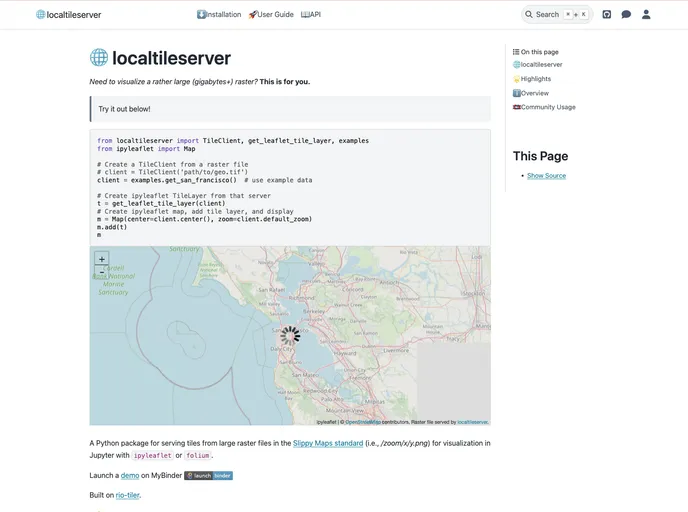
The tile-diagram is a local tile server designed for visualizing large geospatial raster files, particularly those of gigabytes or larger. It serves tiles from these raster files in the Slippy Maps standard for visualization in tools like Jupyter with ipyleaflet or folium. Built on rio-tiler, this tool offers the capability to launch a tile server for large geospatial images, view local or remote raster files, and even visualize rasters in CesiumJS using the built-in web application.
Features
- Serve tiles from large raster files
- Visualize raster files in Jupyter using ipyleaflet or folium
- View rasters with CesiumJS using the built-in web application
- Efficiently deliver varying resolutions of raster imagery
- Support for Cloud Optimized GeoTiffs for remote raster files
Installing with conda
conda install localtileserver
Installing with pip
pip install localtileserver
Summary
The tile-diagram is a handy tool for visualizing large geospatial raster files, offering features like serving tiles, visualizing in Jupyter, and viewing with CesiumJS. With easy installation via conda or pip, users can quickly set up the local tile server and start exploring their raster data.
- Flask

Flask is a lightweight and popular web framework for Python, known for its simplicity and flexibility. It is widely used to build web applications, providing a minimalistic approach to web development with features like routing, templates, and support for extensions.